
Platform & Technology
One operating record. Six technology layers.
The Mutus Tech platform threads soil, crop, climate, satellite and operational data onto a single field-polygon record — and pushes recommendations all the way into the work order, applied-input log and partner-ready report.
The stack
What the platform is made of.
-
Data model
Field polygon as the unit of work
Every plan, task, NDVI scan, input log and report attaches to the same geometry. Multi-farm, multi-tenant, role-based scope (Admin / Adviser / Farmer) — the field polygon you assessed is the polygon you plan, task, monitor and report.
-
Architecture
Mobile-cloud, built for the field
Java/Spring backend on MongoDB with REST APIs; Vue 3 single-page web dashboard; iOS and Android mobile apps for field use. Firebase Cloud Messaging delivers push notifications for due and overdue tasks. The mobile experience is designed to operate in low-connectivity rural areas.
-
Data sources
Multimodal inputs per polygon
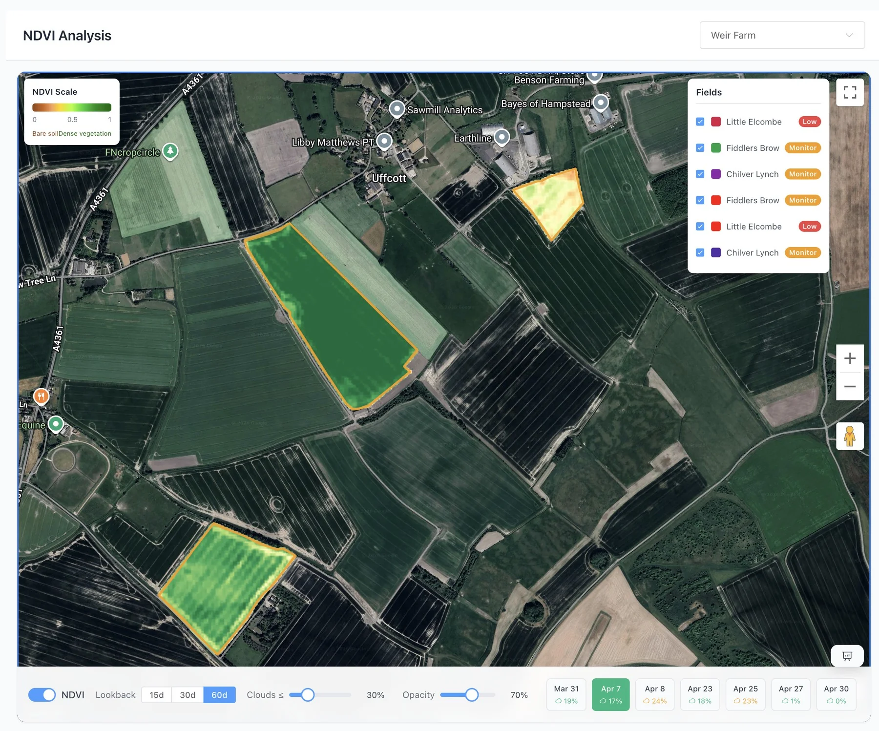
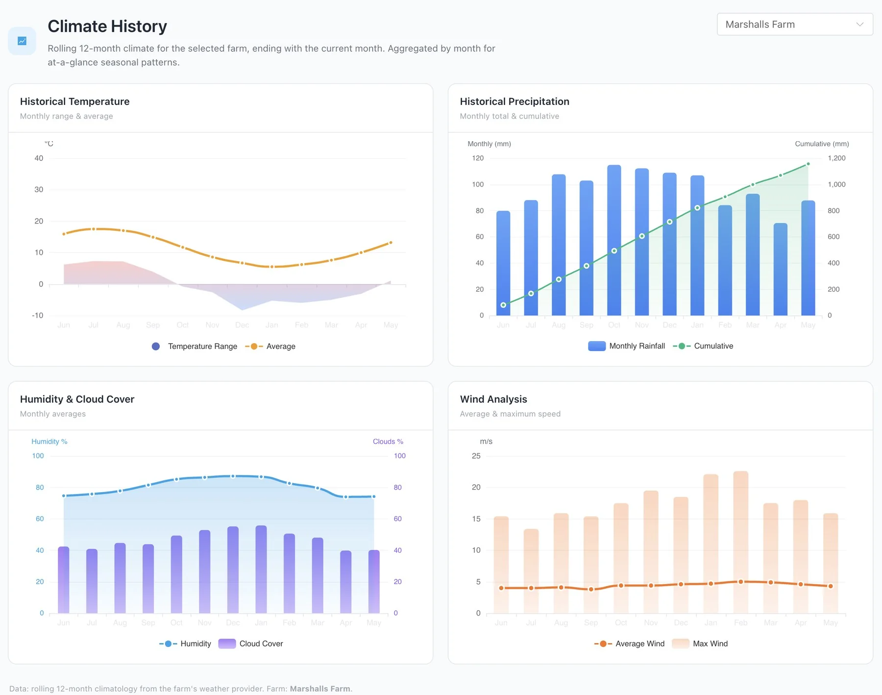
Soil chemistry (pH, P, K, Mg, S, water capacity), crop type and growth stage, weather and climate history, satellite NDVI (Sentinel-2 Copernicus, refresh every ~5 days subject to cloud cover), commodity market prices, and operational activity logs captured from mobile.
-
AI services
Pluggable, research-backed model layer
Recommendation engine implements AHDB RB209 (V08) for nitrogen rates with economic sensitivity checking. DA-Mamba — a state-space model published at IEEE INDIN 2025 — runs as a Parallel Farm microservice for N₂O environmental-performance modelling. Pezego provides AI-powered pest identification as an extension signal.
-
Reporting
Evidence-ready exports
Templated multi-field reports, PDF exports, partner-ready operational records: recommended rate, adjusted rate, applied rate, completion date, photos, input notes, NDVI context and yield indicators — all keyed to the same polygon.
-
Governance
Data isolation and partner due diligence
Role-based access with organisation-level scope isolation. Operating records prepared for partner validation rather than self-issued certification. Provenance, validation-status flags and project-methodology attribution carried with the data. UK-incorporated (Companies House 13274475).
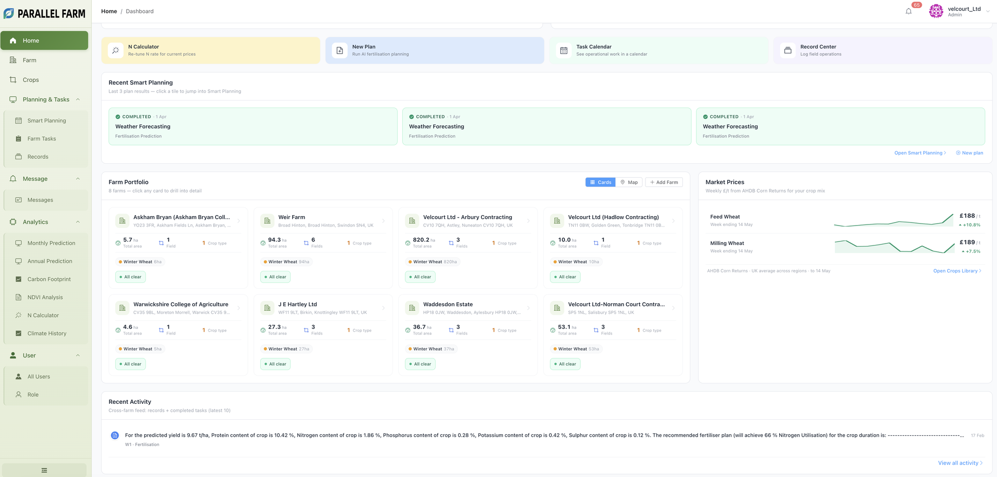
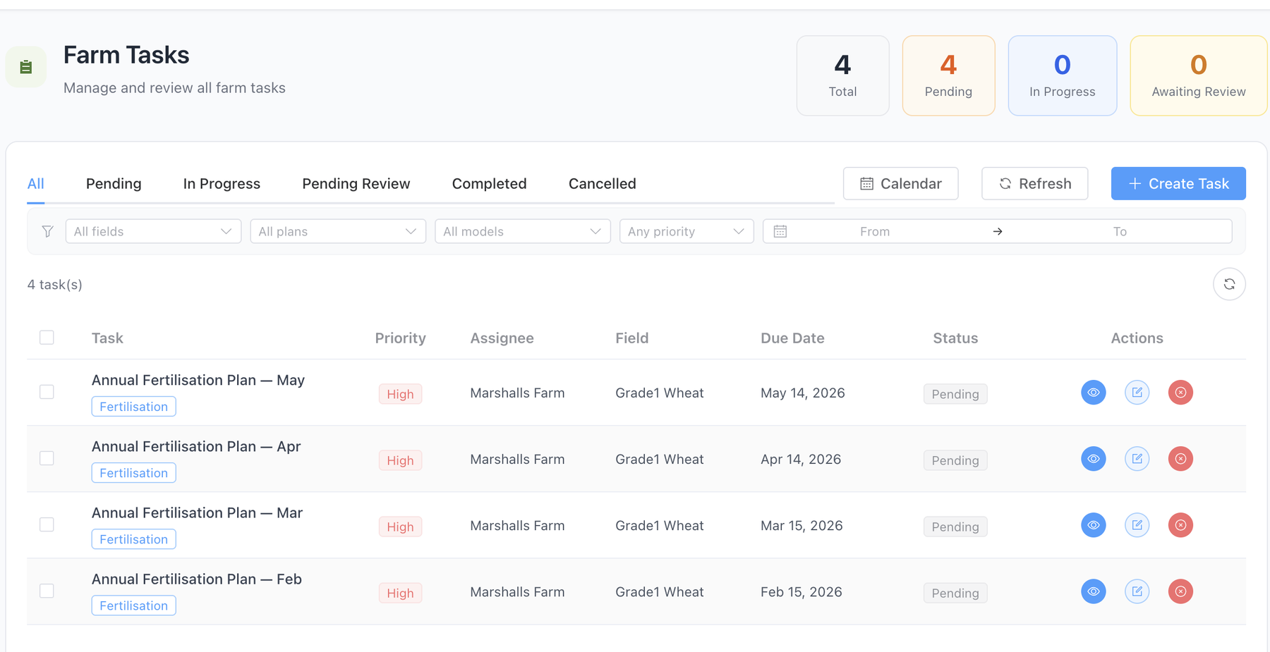
Live modules
Built modules — the same data, surfaced six ways.
Screenshots from the production Parallel Farm environment.
How it threads
From soil chemistry to a partner-ready pack.
Each row is a data path that lives in the platform today. The same polygon is the unit at every step.
| From | → | To | What threads through |
|---|---|---|---|
| Soil tests | → | Annual Prediction | Per-polygon NPKS plan with yield & grain-composition estimate |
| Climate History | → | N Calculator | Economic sensitivity recheck when grain or fertiliser prices move |
| NDVI Analysis | → | Field record | Vegetation-vigour timeline interpreted with management notes |
| Recommendation | → | Farm Tasks | Field-level work order with date, rate, owner, status |
| Applied input | → | Records | Photos, weather snapshot, GPS pin, completion notes |
| Records + NDVI | → | Partner-ready pack | Same polygon, multi-field rollups, PDF / DOCX export |
What we don't claim
Boundaries we observe.
-
NDVI is a signal, not a verdict.
Sentinel-2 NDVI indicates vegetation vigour and crop response. Soil-health interpretation combines NDVI with soil tests, crop context and management records.
-
Models are research-backed, not field-final.
DA-Mamba and our N-rate engine are peer-reviewed modelling bases. Calibration continues through pilot and project partners; field commercial accuracy is partner-validated.
-
Carbon Footprint is estimation, not MRV.
GHG figures are environmental-performance estimates to inform partner conversations — not self-issued MRV, certification or carbon-credit evidence.
-
Evidence is partner-ready, not auditor-stamped.
We prepare operating records for partner review and due diligence. Standards, agronomy and validation partners co-design outcome packs.
Partner with us
Looking at the platform for a research, programme or pilot fit?
We work with universities, agronomy bodies, supply-chain programmes and funders on field-level pilots and validation projects.